PORTFOLIO
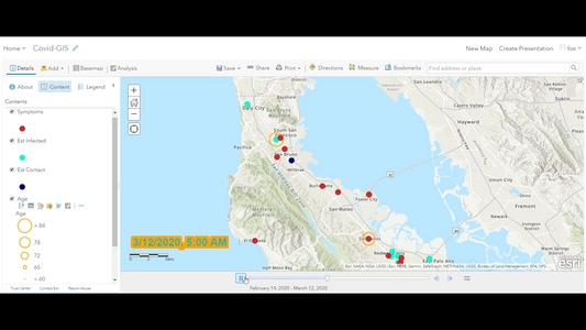
John Hopkins University Covid GIS APP
Developed a COVID-19 time series visualization app using ArcGIS Online, leveraging John Hopkins University data, to map and track patient statuses, contacts, and symptoms in California
John Hopkins University Covid GIS APP
Developed a COVID-19 time series visualization app using ArcGIS Online, leveraging John Hopkins University data, to map and track patient statuses, contacts, and symptoms in California
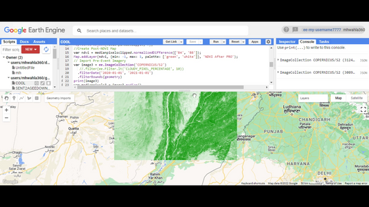
Mapping Multan NDVI Timeseries using Google Ear...
Project Description: In this project centered on Multan, Punjab Pakistan, Change Detection utilizing Google Earth Engine (GEE) and Sentinel-2 imagery was employed to analyze temporal alterations in the region's land...
Mapping Multan NDVI Timeseries using Google Ear...
Project Description: In this project centered on Multan, Punjab Pakistan, Change Detection utilizing Google Earth Engine (GEE) and Sentinel-2 imagery was employed to analyze temporal alterations in the region's land...


